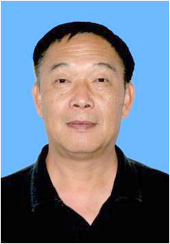
教育背景:
1987.9-1991.6 美国加州大学圣巴巴拉分校计算地球系统科学学院地理学博士
1985.9-1987.7 美国加州大学圣巴巴拉分校计算地球系统科学学院地理学硕士
1978.9-1982.1 中国兰州大学水文地质学及地质工程学学士
科研工作经历:
2010.3 -今 中国科学院遥感与数字地球研究所国家特聘研究员
2001.12 -2010.3 中国科学院遥感应用研究所特聘研究员
2003.2 -2008.7 北京师范大学客座教授
2003.7-2010.3 美国加州大学圣巴巴拉分校计算地球系统科学学院研究员
1999.7-2003.6 美国加州大学圣巴巴拉分校计算地球系统科学学院副研究员
1992.3-1999.6 美国加州大学圣巴巴拉分校计算地球系统科学学院助理研究员
1995.3-1996.6 美国国家宇航局戈达德航天中心(Goddard) 访问学者
1991.12-1992.2 美国加州大学圣巴巴拉分校计算地球系统科学学院博士后及助教
1985-1991 美国加州大学圣巴巴拉分校计算地球系统科学学院博士及助教
1984-1985 中国科学院兰州沙漠研究所水资源室助研
1982-1984 中国水电部水利水电科学研究院助理工程师
研究生培养:
自2001年起,施建成教授已经在中科院遥感地球所建立了一支具有相当水平的研究队伍。现有副研3名,助研3名,博士生在读7名,硕士生在读3名。已培养硕士生5名,博士生30名。
硕士学位:
1. 余 琴,2004年,“基于双极化ASAR数据的雪湿度反演技术研究”
2. 陶 静,2008年,“AMSR-E 土壤水分反演研究”
3. 刘晨洲,2009年,“利用光学数据对含水混合像元微波亮温校正”
4. 李英霞,2013年,“基于遥感的山区森林扰动变化研究”
5. 杨洪波,2013年,“基于虚拟场景的森林散射相位中心高度模拟研究”
6. 胡同喜,2016年,“基于AMSR-E和AMSR2被动微波传感器的地表冻融状态监测”
博士学位:
1. 杨 虎,2004年,“植被覆盖地表土壤水分变化雷达探测模型和应用”
2. 张洪恩,2004年,“青藏高原中分辨率亚象元雪填图算法研究”
3. 王建明,2005年,“基于ERS散射计数据的青藏高原地表土壤水分估算方法研究”
4. 刘 伟,2005年,“植被覆盖地表极化雷达土壤水分反演与应用研究”
5. 蒋玲梅,2005年,“被动微波雪水当量研究”
6. 武胜利,2006年,“基于TRMM的主被动微波遥感结合反演土壤水分算法研究”
7. 杜今阳,2006年,“多极化雷达反演植被覆盖地表土壤水分研究”
8. 许丽娜,2006年,“青藏高原雪盖面积变化分析研究”
9. 毛克彪,2007年,“针对热红外和微波数据的地表温度和土壤水分反演算法研究”
10.陈莹莹,2008年,“基于Noah模型的陆面模拟和陆面数据同化研究”
11.邱玉宝,2008年,“被动微波地表参数反演大气影响分析与校正研究”
12.陈 亮,2009年,“SMOS土壤水分反演算法研究”
13.王永前,2010年,“被动微波遥感大气参数反演和大气校正研究”
14.付秀丽,2010年,“微波辐射计卫星数据模拟与分析的研究”
15.孙瑞静,2010年,“多角度与多极化主动微波数据反演土壤水分研究”
16.殷小军,2011年,“基于AMSR-E的被动微波遥感反演雪水当量”
17.姬大彬,2012年,“被动微波反演陆面云覆盖地区大气水汽和云中液态水”
18.熊 川,2013年,“基于复杂微结构的积雪微波主被动和光学模型研究”
19.郭 鹏,2013年,“基于SMAP的被动微波土壤水分反演”
20.潘火平,2013年,“基于亮温观测数据一维变分同化的微波发射率估算研究”
21.刘晨洲,2013年,“基于SMAP的中高分辨率微波土壤水分反演研究”
22.张 宁,2013年,“基于SMOS卫星数据的植被地上生物量反演算法研究”
23.刘 强,2014年,“AMSR-E土壤水分分析和TRMM降雨降尺度研究”
24.李云青,2015年,“基于 WindSat 数据的低矮植被地上生物量反演算法研究”
25.崔 倩,2015年,“基于SMOS卫星数据的植被光学厚度和土壤水分反演研究”
26.荆莹莹,2015年,“多源卫星大气CO2数据融合与模拟研究”
27.李東洋,2016年,“L波段主被动微波协同反演土壤水分方法研究”
28.彭彬,2016年,“基于L波段微波亮温同化的陆面过程模型状态和参数不确定性估计”
29.邢建勇,2016年,“基于HY-2A多传感器的风反演精度和同化研究”
30.谢彦辉,2016年,“多频微波辐射计卫星数据的前向模拟研究”
专著:
1、J.Shi and Thomas Jackson, “Microwave Vegetation Indices from Satellite Passive Microwave Sensors for Mapping Global Vegetation Cover” in Multiscale Hydrologic Remote Sensing: Perspectives and Applications, Editor, Ni-Bin Chang,Taylor & Francis, 2011.
2、J.Shi,“Active Microwave RS Systems and Applications to Snow Monitoring” in Advances in Land Remote Sensing:System,Modeling, Inversion and Application, Editor, S. Liang, Springer, ISBN 978-1-4020-6449-4, Feb. 2008.
3、J.P.Wigneron,C.M?tzler,S.J.English, A. Jupp, E. P. Dinnat, J. Boutin,J.Shi,M.J.Escorihuela, K. S. Chen,M.Schwank, C. Prigent, P. Rosnay, B. K. Hornbuckle, A. V. Griend, P. Ferrazzoli, L. Guerriero, T. Pellarin, J. C. Calvet, K. Saleh, Y. Kerr, A. Wiesmann, J. Pulliainen, M. Hallikainen, R. T. Tonboe, G. Heygster, L. T. Pedersen, S. Andersen, P. Waldteufel and T. Holmes, Co-Author of Chapter 4: Surface Emission” in Thermal Microwave Radiation: Applications for Remote Sensing, Editor, C. Matzler, ISBN 0863415733, Institute of Electrical Engineers, StevenAge, UK, 2006.
4、施建成,“积雪主动微波遥感”章节,《对地观测微波遥感》,主编:郭华东,郑立中,ISBN:7-03-005093-2/P.879,科学出版社,1995.
代表性论文:
至2017年3月,施建成研究员共发表论文386篇,其中:SCI检索的期刊论文共109篇(包括影响因子3.0以上的49篇,以及一篇Natural-Climate Change合作作者的文章);EI检索论文233篇。文章总引用次数7027次,其中16篇论文单篇引用超过100次,最高单篇引用891次,H-index为37。
1. Ji D, Shi J, Xiong C, et al. A total precipitable water retrieval method over land using the combination of passive microwave and optical remote sensing[J]. Remote Sensing of Environment, 2017, 191: 313-327. (5 Year IF=7.388)
2. C. Xiong, J. Shi, et al., “A New Hybrid Snow Light Scattering Model based on Geometric Optics Theory and Vector Radiative Transfer Theory”, IEEE Transactions on Geoscience and Remote Sensing, Volume: 53, Issue: 9,2015, 10.1109/TGRS.2015.2411592. (5 Year IF =3.863)
3. Jun Yang, Peng Gong, Rong Fu, Minghua Zhang, Jingming Chen, Shunlin Liang, Bing Xu, Jiancheng Shi and Robert Dickinson, "The role of satellite remote sensing in climate change studies,” Nature Climate Change, DOI: 10.1038/NCLIMATE1908, Sept., 2013. (5 Year IF = 19.257)
4. J. Shi et al., “Progresses on Microwave Remote Sensing of Land Surface Parameters,” Science China, Earth Sciences, 55(7):1052-1078, 2012. (5 Year IF = 1.850)
5. T. Zhao, L.X. Zhang, J. Shi, and L. Jiang “A Physically Based Statistical Methodology for Surface Soil Moisture Retrieval in the Tibet Plateau Using Microwave Vegetation Indices”, Journal of Geophysical Research - Atmospheres, 116, D08116, DOI: 10.1029/2010JD015229, 2011. (5 Year IF = 3.651)
6. J.Y. Du, J. Shi, and Helmut Rott “Comparison between a Multi-scattering and Multi-layer Snow Scattering Model and its Parameterized Snow Backscattering Model”, Remote Sensing of Environment, 114(5): 1089-1098, 2010. (5 Year IF=7.388)
7. J. Shi, T. Jackson, J. Tao, J. Du, R. Bindlish, L. Lu, and K. S. Chen, “Microwave vegetation indices for short vegetation covers from satellite passive microwave sensor AMSR-E”, Remote Sensing Of Environment, Vol. 112, No. 12, pp. 4285-4300, Dec., 2008. (5 Year IF=7.388)
8. J.Shi, L. M. Jiang, L. X. Zhang, K. S. Chen, J. P Wigneron, A. Chanzy, and T. Jackson, “Physically Based Estimation of Bare Surface Soil Moisture with the Passive Radiometers”, IEEE Transactions on Geoscience and Remote Sensing, 44(11): 3145-3153, Nov, 2006. (5 Year IF =3.863)
9. J.Shi, L. M. Jiang, L. X. Zhang, K. S. Chen, J. P Wigneron, and A. Chanzy, “A Parameterized Multi-Frequency-Polarization Surface Emission Model”, IEEE Transactions on Geoscience and Remote Sensing, 43(12):2831-2841, 2005. (5 Year IF =3.863)
10.J.Shi, K. S. Chen, Q. Li, T. J. Jackson, P.E. O’Neill, and L. Tsang, “A parameterized Surface Reflectivity Model and Estimation of Bare Surface Soil Moisture with L-band Radiometer”, IEEE Transactions on Geoscience and Remote Sensing, 40(12):2674-2686, Dec. 2002. (5 Year IF =3.863)
11.J.Shi and J. Dozier,“Estimation of Snow Water Equivalence Using SIR-C/X-SAR, Part II: Inferring snow depth and particle size”, IEEE Transactions on Geoscience and Remote Sensing, Vol. 38, No. 6, pp. 2475-2488, Nov. 2000. (5 Year IF =3.863)
12.J.Shi and J. Dozier,“Estimation of Snow Water Equivalence Using SIR-C/X-SAR, Part I: Inferring snow density and subsurface properties”, IEEE Transactions on Geoscience and Remote Sensing, Vol. 38, No. 6, pp. 2465-2474, Nov. 2000. (5 Year IF =3.863)
13.J.Shi, J. Wang, A. Hsu, P. ONeill, and E. T. Engman, “Estimation of bare surface soil moisture and surface roughness parameter using L-band SAR image data”, IEEE Transactions On Geoscience and Remote Sensing, Vol.35, no.5, pp.1254-1266, 1997. (5 Year IF =3.863)
14.J.Shi, J. Wang, A. Hsu, P. O'Neill, and E. T. Engman, “Estimation of bare surface soil moisture and surface roughness parameters using L-band SAR image data”, IEEE Transactions on Geoscience and Remote Sensing, Vol. 35, no. 5, pp. 1254-1266, 1997. (5 Year IF =3.863)
15.J.Shi and J. Dozier, “Mapping Seasonal Snow with SIR-C/X-SAR in Mountainous Areas”, Remote Sensing of Environment, vol. 59, no. 2, pp. 294-307, 1997. (5 Year IF=7.388)
16.J.Shi and J. Dozier, “Inferring snow wetness using SIR-C C-band polarimetric synthetic aperture radar”, IEEE Transactions on Geoscience and Remote Sensing, vol. 33, no. 4, pp. 905-914, 1995. (5 Year IF =3.863)
17.J.Shi, J. Dozier, and H. Rott,“Snow mapping in alpine regions with synthetic aperture radar”, IEEE Transactions on Geoscience and Remote Sensing, vol. 32, no. 1, pp. 152-158, 1994. (5 Year IF =3.863)